
Applications
Locating Underground Oil Tanks (USTs)
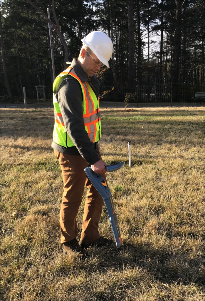
Earth Image Geophysics uses a combination of electromagnetic scanning techniques (EM-31 or EM-38), ground penetrating radar (GPR), and Radiodetect to locate USTs or other buried objects.
Many older homes relied on oil for heat and used underground storage tanks as a result. Sometimes these tanks remain on the property and may present a risk of soil contamination. Although mapping buried utility lines is often important on a geophysical survey, those seeking utility clearance for excavation permits should consult a specialist in that area.
Archaeological Survey
Earth Image Geophysics can assist in archaeological investigations by providing a combination of non-invasive mapping techniques, such as electromagnetic mapping, ground penetrating radar, and magnetometry. These techniques can provide a useful overview of the character of a site and help narrow down potential locations for excavation.
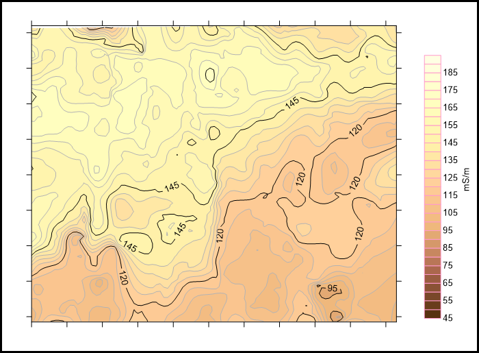
Electromagnetic and magnetic mapping can detect subtle changes in conductivity and magnetic field strength, revealing historic human impacts such as building footings, buried refuse, pit houses, and burials. The effective survey depth of investigation is 5.5 meters with the EM-31, while the EM-38 provides a higher resolution but shallower measurement of conductivity within the upper 1.5 meters. The effective depth of investigation of the magnetometer is dependant on the size and material of the target.
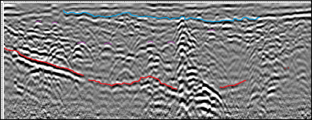
Ground Penetrating Radar (GPR) can provide useful information about specific archaeological targets including the approximate depth and size of the buried objects of interest. It can effectively image objects up to 20 meters in depth in ideal conditions. More often effective depths of investigation are in the range of 2 to 6 meters.
Mapping shallow bedrock
Shallow bedrock can be mapped with ground penetrating radar and electromagnetic instruments depending on the properties of the bedrock and overburden. Given sufficient contrast in electrical properties, shallow bedrock can be detected and mapped to depths up to 4 meters with the EM-31. Ground penetrating radar can image bedrock surfaces up to 20 meters below ground surface, however this is highly dependent on soil conductivity and the effective depth range can be limited to as little as 2 meters.
Void Detection
Shallow subsurface voids can be delineated with ground penetrating radar; electromagnetic profiling may also be useful in some contexts. Air or water filled voids provide a stark contrast against the surrounding overburden allowing clear imaging if they are within range. Investigation depth depends on the size of the void and intervening material. Our methods are generally effective at detecting voids up to a depth of 5 meters. Large voids or mine workings at greater depths may require other methods such as electrical resistivity tomography which is not currently offered by Earth Image Geophysics.
Environmental Site Classification
Environmental contaminants often alter soil conductivity and can therefore be mapped using electromagnetic methods at relatively low cost. In addition to detecting and mapping contaminant plumes, this approach can also reveal changes in soil type, shallow bedrock, and buried objects.
Identify and Map Historic Stream Channels
Palaeochannels are inactive stream channels that have been infilled or buried with sediment. If the infilled sediment is more permeable than the surrounding sediments, these channels will act as conduits for groundwater. Mapping paleochannels can clarify site hydrogeology, supporting efforts to control the flow of ground water contaminates or salt water.